Tag Archives: ArcGIS

Baldwin County GA Sheriff’s Office Deploys Case Closed Software for Investigation Case Management

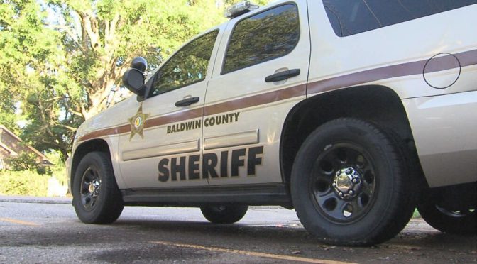
Baldwin County, GA – (August 1, 2021)  The Baldwin County Sheriff’s Office has announced the implementation of new investigation case management software from Case Closed Software, a leading provider of investigative technology solutions.
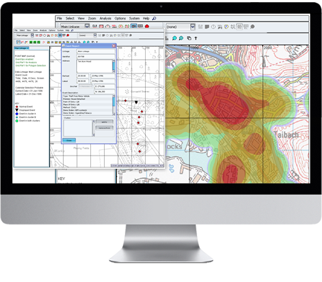
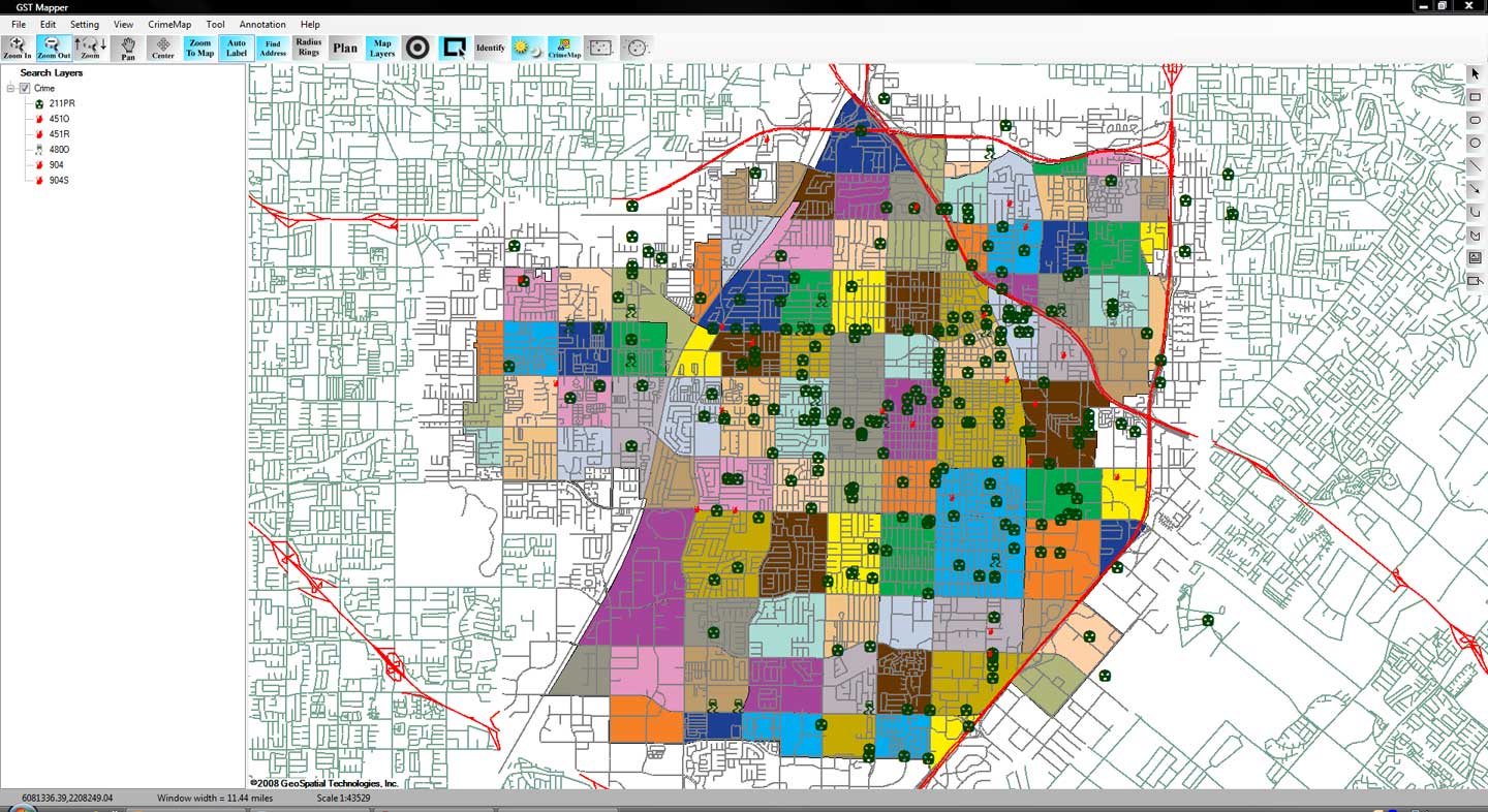
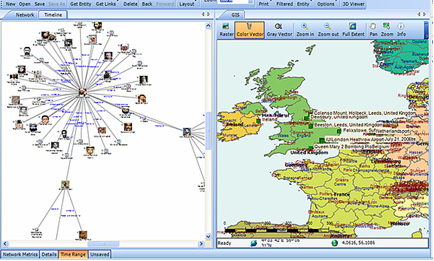
The new software will enhance the Sheriff’s Office’s ability to manage and solve cases by streamlining case management, reducing manual work, and providing real-time access to critical information. The system will provide investigators with powerful tools that will help them manage their caseloads, track evidence, and collaborate more efficiently.

The implementation of Case Closed Software will also allow the Baldwin County Sheriff’s Office to streamline its investigation process, improve its ability to analyze case data, and increase collaboration between investigators. The software will also provide real-time updates to case status and allow investigators to share case files across departments and agencies.

“We are thrilled to partner with the Baldwin County Sheriff’s Office to help them take their investigative capabilities to the next level,” said Douglas Wood, CEO of Case Closed Software. “Our software is designed to give investigators the tools they need to manage their caseloads, track evidence, and solve cases more efficiently, and we are confident that it will make a real difference for the Sheriff’s Office.”

Case Closed Software is a leading provider of investigation case management software for law enforcement, state and local government agencies, and private sector organizations. The company’s software solutions are designed to improve the efficiency and effectiveness of investigations, streamline case management, and reduce costs.

Crime Hot Spots and Risk Terrain Modeling

abmpegasus-intelligence-led-policing
A typical ‘hot spot’ in crime analytics

By Tyler Wood, Operations Manager at Crime Tech Solutions.
One of the many functions crime analysis performs is the identification of “hot spots”, or geographical areas that seem to be hubs for criminal activity. Identifying these hot spots through best practices in geospatial crime mapping allows law enforcement to focus their efforts in areas that need them most. The trouble that law enforcement and crime analysts have encountered is displacement – the fact that once a hot spot is “cleared”, crime seems to pop up again in a different location. The good news is that the displacement is never 100%, so policing hot spots is important – it’s just not a magic bullet.
To solve this problem, a team at Rutgers University’s School of Criminal Justice set out to develop new methodologies that would result in peaceful outcomes that are built to last instead of merely temporary.
The difference between the old approach and the new approach is stark. Where police and analysts used to focus solely on geographical concentration of crimes, Risk Terrain Modeling examines the factors that contribute to such dense concentrations to begin with. Rutgers team have identified several characteristics of any given geographical location which may attract or generate crime. Their technology takes these characteristics, which include socioeconomic data, physical layout, types of local businesses, etc… and uses them to calculate the likelihood crime occurring in the area. This allows law enforcement to be proactive in the prevention of crime in these areas.
CrimeMapLite
Advanced crime analytics show statistically significant risk factors.

The technique seems to be highly effective. After a trial run in New Haven, CT, police were able to identify sixteen “statistically significant risk factors that underlie violent crime occurrences.” A high percentage of violent crime in New Haven during the test period occurred in locations already identified by the concept of risk terrain modeling. Though the technology is still new, it is clearly showing impressive results already.
Shutting down hot spots is important policing, and risk terrain modeling technology allows analysts and law enforcement officers to be even more proactive in their prevention of crime.
The author, Tyler Wood, is head of operations at Austin, TX based Crime Tech Solutions – an innovator in crime analytics and law enforcement crime-fighting software. The clear price/performance leader for crime fighting software, the company’s offerings include sophisticated Case Closed™ investigative case management and major case management, GangBuster™ gang intelligence software, powerful link analysis software, evidence management, mobile applications for law enforcement, comprehensive crime analytics with mapping and predictive policing, and 28 CFR Part 23 compliant criminal intelligence database management systems.)

Crime Tech Solutions Acquires Case Closed Software

June 1, 2016 (Austin, TX)   Crime Tech Solutions, LLC, a leading provider of analytics and investigation software for law enforcement and commercial markets, today announced that it has acquired Cleveland, TN based Case Closed Software in a cash transaction. The terms of the deal were not released, but according to Crime Tech Solutions’ founder and president Douglas Wood, the acquisition brings together two dynamic and fast-growing software companies with an unparalleled complement of technologies.
For Crime Tech Solutions, the opportunity to add Case Closed Software into the fold was too good to pass up” said Mr. Wood. “We think that the technology offered by Case Closed helps to further differentiate us in the market as the price performance leader for this type of investigative solution.PNG
Crime Tech Solutions, based in the city of Leander, TX, delivers advanced analytics and investigation software to commercial investigators and law enforcement agencies across the globe. Their solution suite includes criminal intelligence software, sophisticated crime analytics with geospatial mapping, and powerful link analysis and visualization software. The company says that the addition of Case Closed Software expands those offerings even further.
Case Closed Software develops and markets investigative case management software specifically designed for law enforcement agencies. The suite is built around four primary software products including best-in-class investigative case management software, property and evidence tracking, a gang database tool, and an integrated link analysis and data visualization tool. The company also plans to release the solution as Case Closed Cloud for cloud-based access.
Case Closed couldn’t be happier than to be joining Crime Tech Solutions,” said Keith Weigand, the company’s founder. “The blending of our technologies creates a suite that will add tremendous value to our mutual customers, and will be hard for others to duplicate.
According to both Mr. Weigand and Mr. Wood, the name Case Closed will continue on as the product brand, given its widespread popularity and loyal customer base. Crime Tech Solutions is expected to retain all Case Closed employees, with Mr. Weigand joining as the company’s chief technical officer.
Crime Tech Solutions says it expects continued growth via ongoing software sales and strategic acquisitions.
About Crime Tech Solutions
(NOTE: Crime Tech Solutions is an Austin, TX based provider of crime and fraud analytics software for commercial and law enforcement groups. Our offerings include sophisticated Case Closed™ investigative case management and major case management, GangBuster™ gang intelligence software, powerful link analysis software, evidence management, mobile applications for law enforcement, comprehensive crime analytics with mapping and predictive policing, and 28 CFR Part 23 compliant criminal intelligence database management systems.)

What is Geospatial Crime Mapping?

Geospatial4Posted by Crime Tech Solutions with information gathered from Wikipedia.
Here’s a fact: Any understanding of where and why crimes occur can help prevent future crimes.
Mapping crime can help law enforcement protect citizens more effectively. Simple maps that display the locations where crimes or concentrations of crimes have occurred can be used to help direct patrols to places they are most needed. Policymakers can use more complex maps to observe trends in criminal activity; such maps can prove invaluable in solving criminal cases. For example, detectives can use maps to better understand the hunting patterns of serial criminals and to hypothesize where these offenders might live.
Products like CrimeMap Pro™ from Crime Tech Solutions are used by analysts in law enforcement agencies to map, visualize, and analyze crime incident patterns. It is a key component of crime analysis and the CompStat policing strategy. Mapping crime, using Geographic Information Systems (GIS), allows crime analysts to identify crime hot spots, along with other trends and patterns.CrimeMapLite

Using GIS, crime analysts can overlay other datasets such as census demographics, locations of pawn shops, schools, etc., to better understand the underlying causes of crime and help law enforcement administrators to devise strategies to deal with the problem. GIS is also useful for law enforcement operations, such as allocating police officers and dispatching to emergencies.

Crime analysts use crime mapping and analysis to help law enforcement management (e.g. the police chief) to make better decisions, target resources, and formulate strategies, as well as for tactical analysis (e.g. crime forecasting, geographic profiling). New York City does this through the CompStat approach, though that way of thinking deals more with the short term. There are other, related approaches with terms including Information-led policing, Intelligence-led policing, Problem-oriented policing, and Community policing. In some law enforcement agencies, crime analysts work in civilian positions, while in other agencies, crime analysts are sworn officers.
From a research and policy perspective, crime mapping is used to understand patterns of incarceration and recidivism, help target resources and programs, evaluate crime prevention or crime reduction programs (e.g. Project Safe Neighborhoods, Weed & Seed and as proposed in Fixing Broken Windows), and further understanding of causes of crime.
The boom of internet technologies, particularly web-based geographic information system (GIS) technologies, is opening new opportunities for use of crime mapping to support crime prevention. Research indicates that the functions provided in web-based crime mapping are less than in most traditional crime mapping software. In conclusion, existing works of web-based crime mapping focus on supporting community policing rather than analytical functions such as pattern analysis and prediction.