By Tyler Wood, Operations Manager at Crime Tech Solutions.
One of the many functions crime analysis performs is the identification of “hot spots”, or geographical areas that seem to be hubs for criminal activity. Identifying these hot spots through best practices in geospatial crime mapping allows law enforcement to focus their efforts in areas that need them most. The trouble that law enforcement and crime analysts have encountered is displacement – the fact that once a hot spot is “cleared”, crime seems to pop up again in a different location. The good news is that the displacement is never 100%, so policing hot spots is important – it’s just not a magic bullet.
To solve this problem, a team at Rutgers University’s School of Criminal Justice set out to develop new methodologies that would result in peaceful outcomes that are built to last instead of merely temporary.
The difference between the old approach and the new approach is stark. Where police and analysts used to focus solely on geographical concentration of crimes, Risk Terrain Modeling examines the factors that contribute to such dense concentrations to begin with. Rutgers team have identified several characteristics of any given geographical location which may attract or generate crime. Their technology takes these characteristics, which include socioeconomic data, physical layout, types of local businesses, etc… and uses them to calculate the likelihood crime occurring in the area. This allows law enforcement to be proactive in the prevention of crime in these areas.
The technique seems to be highly effective. After a trial run in New Haven, CT, police were able to identify sixteen “statistically significant risk factors that underlie violent crime occurrences.” A high percentage of violent crime in New Haven during the test period occurred in locations already identified by the concept of risk terrain modeling. Though the technology is still new, it is clearly showing impressive results already.
Shutting down hot spots is important policing, and risk terrain modeling technology allows analysts and law enforcement officers to be even more proactive in their prevention of crime.
The author, Tyler Wood, is head of operations at Austin, TX based Crime Tech Solutions – an innovator in crime analytics and law enforcement crime-fighting software. The clear price/performance leader for crime fighting software, the company’s offerings include sophisticated Case Closed™ investigative case management and major case management, GangBuster™ gang intelligence software, powerful link analysis software, evidence management, mobile applications for law enforcement, comprehensive crime analytics with mapping and predictive policing, and 28 CFR Part 23 compliant criminal intelligence database management systems.)
Tag Archives: heat mapping
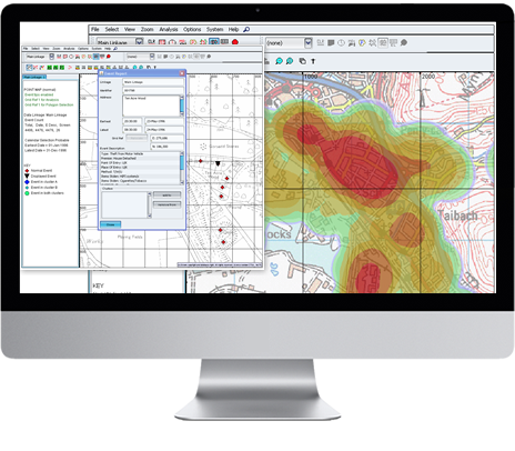
Best Practices – Geospatial Crime Mapping
Posted by Tyler Wood, Operations Manager at Crime Tech Solutions.

Crime mapping technology is a powerful and valuable tool for law enforcement. The ability to represent crime statistics visually – in a meaningful way – is helping police forces across America to analyze, understand, predict, and even prevent crime. It is, however, important to use caution when using such powerful tools, in order to prevent incorrect analyses of crime statistics that may hinder, rather than help, an investigation.
Specifically, there are a few key mistakes which should be avoided when utilizing this sort of predictive technology.
- Obviously, crime reporting should be thorough and detailed. Crime mapping technology takes a great many factors into consideration when developing a visual analysis of a certain area. The more detailed the input is, the more accurate the predictions and visualizations will be.
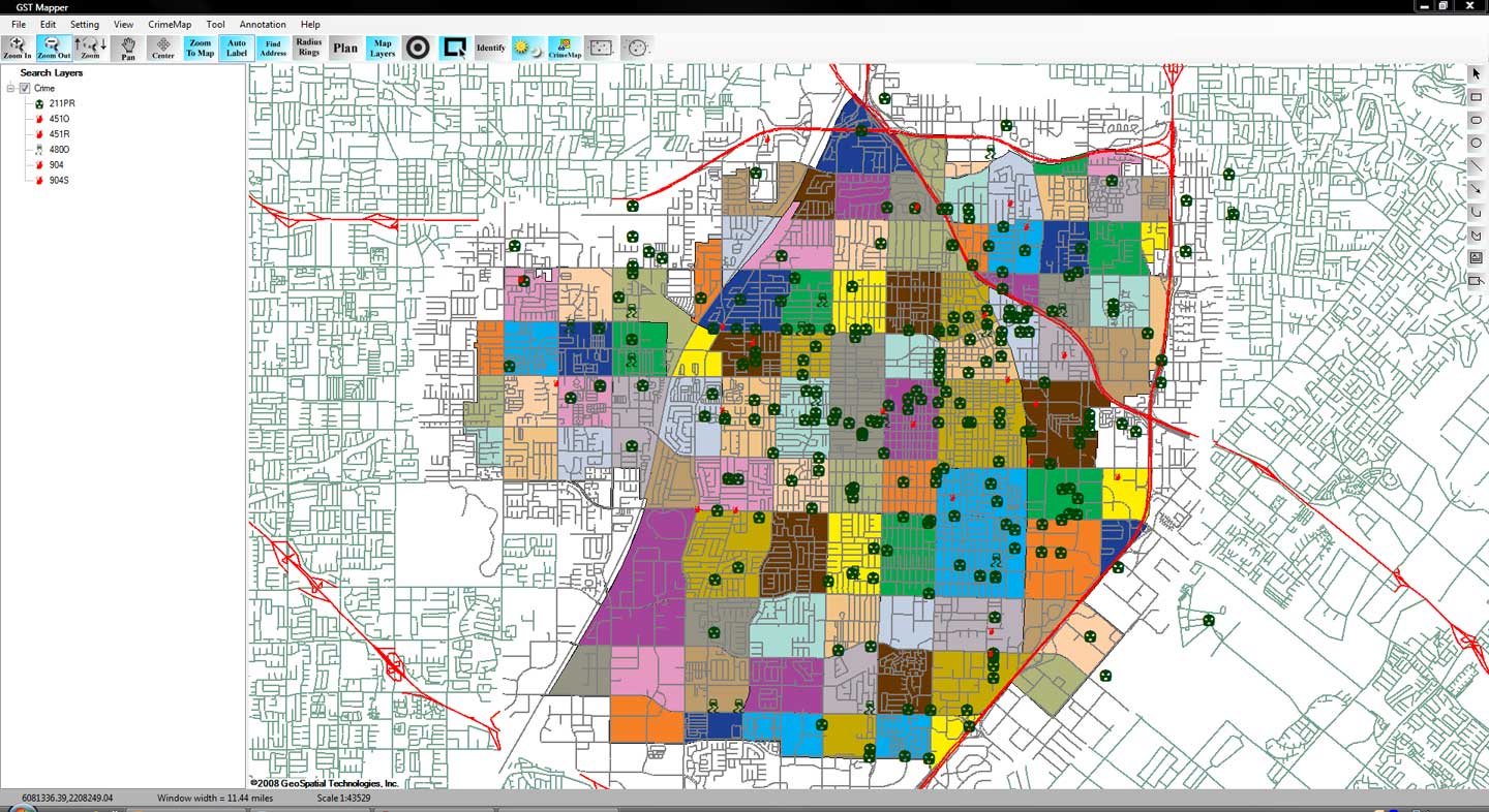
- Not every crime occurs at a specific street address. Certain crimes, like personal theft, may not be noticed until hours or even days after they occur, making it difficult to define an exact location at which the crime was committed. Analysts should take care to visualize each location in which it could have occurred.
- When developing a crime map of an area, analysts should take care to split the data between daytime and nighttime hours, as many areas have significantly different rates of crime depending on the time of day. If time is not taken into consideration, data can become skewed and law enforcement can develop a warped picture of the area.
- It is also important for analysts to consider other factors that affect crime reporting within a specific area. For example, petty crimes may be reported less often in lower-income neighborhoods. Care should be taken to consider the demographics and socioeconomic standings of the area being mapped in order to provide more context which can help analysts to more accurately predict and prevent crime.
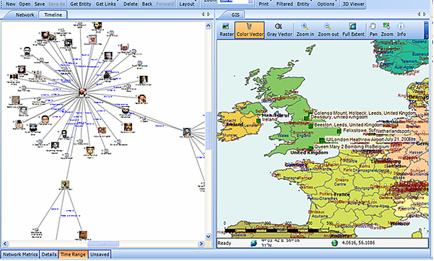 Combining, where possible, the functionality of link analysis into the crime mapping process brings powerful additional functionality. This ability to link, not only statistical, but entity-specific data is a potential game changer.
The role of crime mapping in the world of law enforcement is gaining popularity. Unfortunately, for many police departments, the cost of a full suite of software from category leader, ESRI is prohibitive. Still, there are options available… notably, CrimeMap Pro from Crime Tech Solutions.
___
(NOTE: Crime Tech Solutions is an Austin, TX based provider of crime and fraud analytics software for commercial and law enforcement groups. We proudly support the Association of Certified Fraud Examiners (ACFE), International Association of Chiefs of Police (IACP), Association of Law Enforcement Intelligence Units (LEIU) and International Association of Crime Analysts (IACA). Our offerings include sophisticated link analysis software, comprehensive crime mapping and predictive policing, and criminal intelligence database management systems.)